
General archipelago illustration. The photo was not taken at the destination.
Stora Hästö by boat – a nature trail below and above the water
Stora Hästö is an island in the Archipelago National Park south-west of Korpoström. Its shallow waters are home to Metsähallitus's first underwater nature trail, which you can explore by snorkelling or swimming, and on land a nature trail leads up to high rocks with wide views. There is no jetty on the island; boats moor in the natural harbour. Set aside a full day for the trip.
Details checked against sources in October 2026.
Services on site
- Natural shore
- Toilet
- Barbecue area
- Nature trail
- No fuel
- No water point
Many services are only open in the summer season, so check opening hours on the destination's website.
Why go to Stora Hästö?
About 90 per cent of the Archipelago National Park is under water. On Stora Hästö, this world is easy to explore: the island's shallow waters are home to Metsähallitus's first underwater nature trail, whose information boards are attached to concrete slabs on the seabed and whose routes are connected by a rope.
There are two underwater routes. The Harbour Porpoise route (Pikkupyöriäinen), about 150 metres long, is marked with an orange rope and runs at a depth of about 1–1.5 metres, so you can follow it by snorkelling or swimming. Along the way you can see eelgrass, bladderwrack, blue mussels and harmless jellyfish, among other things. The Grey Seal route (Harmaahylje), about 300 metres long, is marked with a blue rope and is intended for scuba divers. Deeper down, at about five metres, there is also a rowing boat wreck sunk by Metsähallitus, which shows how a wreck becomes part of the seabed.
In the western part of the island, a nature trail of about 1.6 kilometres has information along the way about changes in the sea and water protection. The trail runs through forest and over rocks with plenty of ups and downs, and it offers fine sea views. Metsähallitus recommends walking it clockwise. Sheep graze on the island in summer.
Who is this trip for?
The trip suits swimmers, snorkellers and families with children who want to see underwater nature, as well as anyone who enjoys a natural harbour with a picnic, a walk and a swim. The water is usually clear for almost the whole summer.
You can also rent the Buster Magnum from us for longer, as long as you need. Stora Hästö has a camping area, so the island offers a peaceful place to stay on a longer archipelago trip.
Route to Stora Hästö
Hovirinta → Stora Hästö
- Distance / one way
- 44 nm
- Travel time / one way
- approx. 1 h 50 min
- Fuel / one way
- approx. 33 l
- Fuel / round trip
- approx. 66 l
The fuel estimate is based on a consumption of 0.75 l/nm. Actual consumption depends on the weather, load and driving style.
Stora Hästö is one of our more distant destinations. There are shallows and rocks at and near the mouth of the bay, so study the approach carefully on a paper chart before you set off. Keep an eye on the weather throughout the day and plan refuelling in advance, as there is no fuel on the island.
Loading the map…
Travel times are estimates without stops and depend on the conditions. The round-trip fuel estimate assumes you return the same way. Also allow time for the destination itself and for the boat handover and safety briefing of approx. 30 minutes at the start of the rental.
Wind forecast: Stora Hästö
Loading the wind forecast…
Suggested plan for the day
This is a flexible idea for a self-guided nature trip to Stora Hästö.
- 01
Check the weather and wind forecast and study the approach on a paper chart.
- 02
Set off in the morning so that you have time for an unhurried day on the island.
- 03
Moor on the south side of the natural harbour with an anchor and to the rock rings.
- 04
Snorkel or swim the underwater nature trail, which starts behind the headland to the right of the entrance.
- 05
Walk the trail on land up to the viewpoints and have a picnic at the campfire site.
- 06
Start the return trip in good time, taking into account the weather and the boat's return time.
Natural harbour and mooring
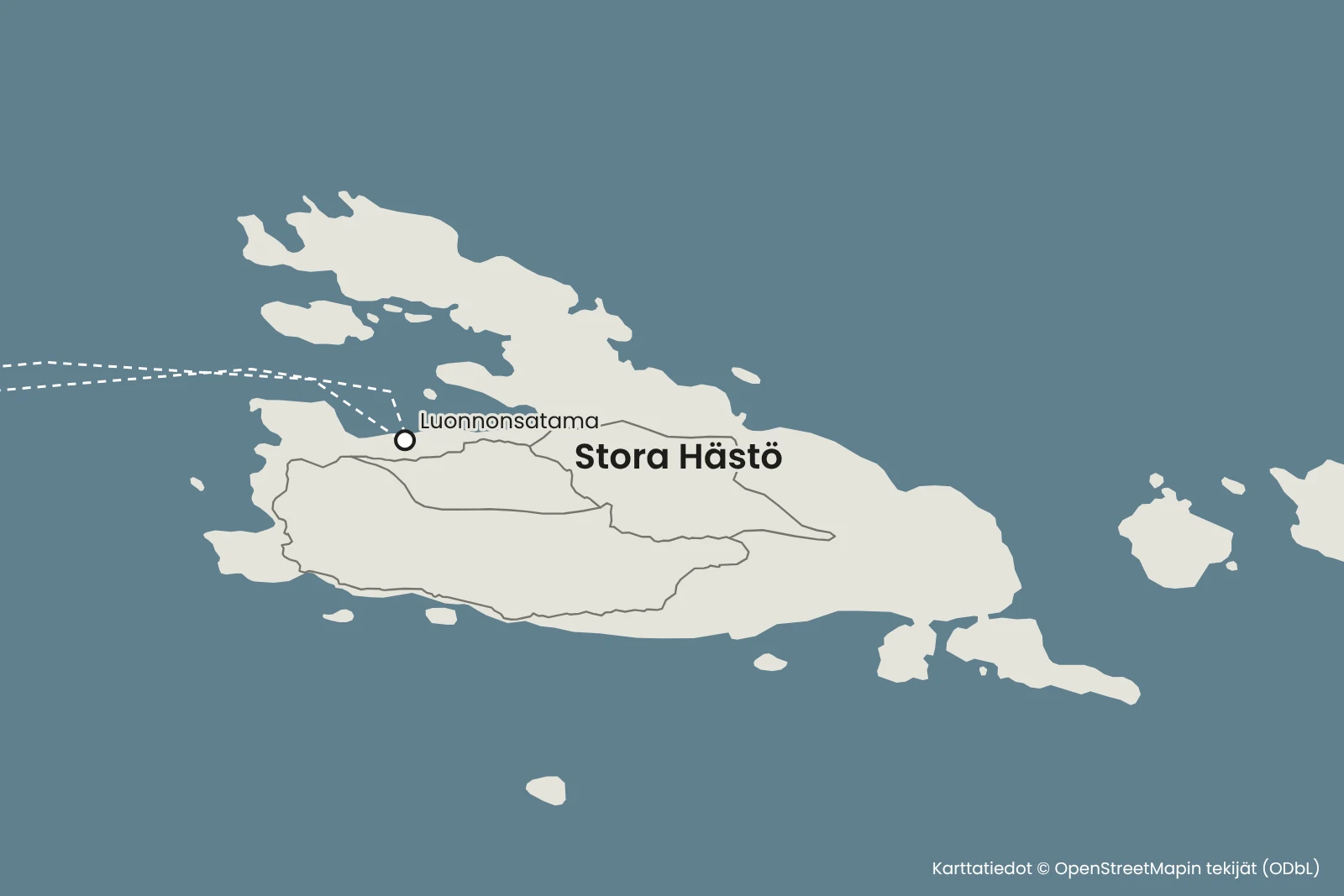
The natural harbour of Stora Hästö is a sheltered bay on the west side of the island. There is no jetty, so boats moor with the bow to the rock and the stern to an anchor. There are mooring rings on the south side of the bay, and the anchor holds well in the seabed. The depth is about 1.5–2.5 metres, and there are a few rocks along the shoreline, so look for a mooring spot with a suitable depth for the boat.
Drop the stern anchor well before the shore and slowly bring the bow to the rock. If mooring with a stern anchor is new to you, ask us for tips before you set off.
Important: anchoring near the underwater nature trail is not allowed, and the trail's buoys must not be touched.
The bay is sheltered from most winds, but a strong north-westerly or westerly wind makes the mooring spot uncomfortable. In that case, move to a more sheltered spot in good time, for example at the eastern end of the island.
Hiking facilities and national park rules
On the shore there is an information point, a campfire site and a woodshed, as well as a dry toilet and a camping area. Always check whether a wildfire warning is in force before lighting a fire.
The starting point of the underwater nature trail is marked with a white buoy, and the texts on the information boards are in Finnish and Swedish. Exploring the deeper route and the wreck requires diving equipment, but in clear water you can see the bottom of the shallower route from the surface while snorkelling.
Stora Hästö is part of the Archipelago National Park, where everyman's rights do not apply as such. Read the national park's regulations before your trip. The service season runs from June to September.
There is no fuel on the island. Refuel on the way if needed, for example in Korpoström or Nauvo. The Buster Magnum runs on 98E5.
Remember before you set off
- Bring snorkels, swimming goggles and swimwear.
- Make sure the stern anchor and lines are ready before landing.
- Check the approach on a paper chart and make sure you have enough fuel.
- Bring drinking water, food and a rubbish bag.
- Pack shoes suitable for the nature trail.
Shall we head to Stora Hästö for the day?
Choose a departure point, look at the route and check the Buster Magnum's availability.
Friilo may open in Finnish – you can easily switch the language on the page.
See also
- SeiliPlan a boat trip to Seili from Hovirinta in Kaarina or Särkänsalmi in Naantali. Travel estimates, trip tips and the Buster Magnum for rent.Read the trip guide
- MaisaariPlan a boat trip to Maisaari for your family or group: a pizza stop, a wood-fired sauna and accommodation for over 50 people. Route and travel times from Hovirinta and Särkänsalmi.Read the trip guide
- AhvensaariAhvensaari is an old mining island in Korppoo with a clear lake in a former limestone quarry. Boat route, travel time and tips for landing on a natural shore.Read the trip guide
Similar destinations by theme: For families with children