
Ahvensaari by boat – an old mining island and a clear quarry lake
Ahvensaari has no guest jetty and no services. Instead, you get a peaceful natural shore, fascinating mining history and a clear lake in an old limestone quarry.
Details checked against sources in October 2026.
Services on site
- Natural shore
No services: bring food, drinks and a rubbish bag.
Why go to Ahvensaari?
Ahvensaari (Åvensor in Swedish) is an island of about five square kilometres in Korppoo (Korpo), between Rymättylä and Houtskär. The island has probably been inhabited since the 14th–15th centuries, and the village is mentioned in the land registers of the 1530s. The compact village was destroyed by fire in 1690 and rebuilt as a row village. The village is part of the nationally significant archipelago settlement of western Turunmaa.
The island's limestone deposit was discovered in the 18th century, and the islanders built the first lime kiln in the 19th century. The limestone mine operated from 1845, and its heyday began in the 1930s, when Paraisten Kalkkivuori, today Nordkalk, expanded the operations. The mine provided a living for dozens of families, and at its peak Ahvensaari was the largest village in old Korppoo, with a school, a shop and a lively village life. The mine closed in 1956 and the village school in 1967, and today about ten people live on the island all year round.
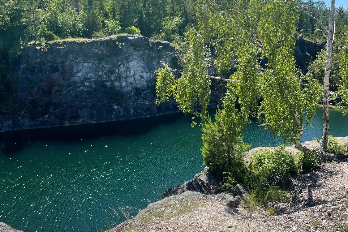
There are two limestone quarries, on the Kirmo and Kilamo headlands on the island's north shore. A clear lake has formed in the old Kilamo quarry, surrounded by steep limestone cliffs that glow white. The water is turquoise and cold, and perch and crayfish live in the lake. Catching crayfish is not allowed, but you can watch them.
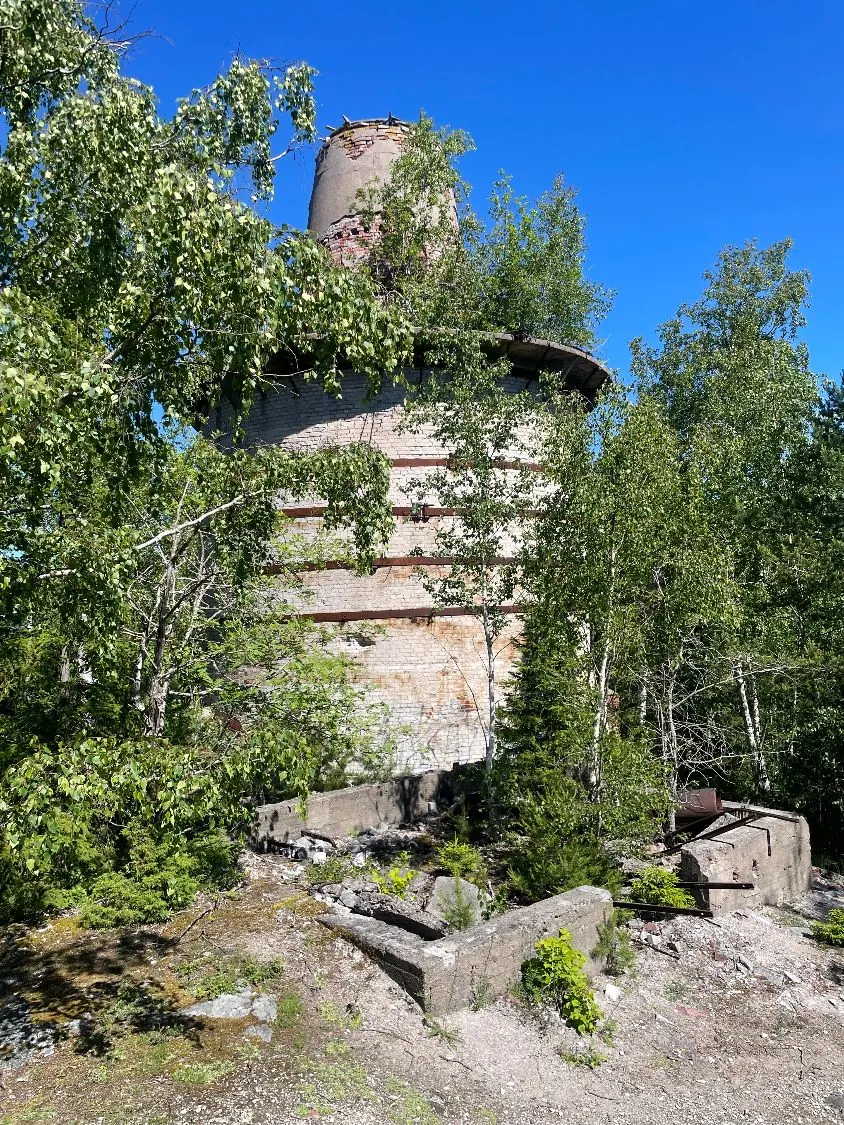
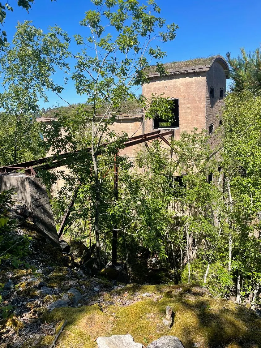
The limestone-rich soil makes the nature unusual for the archipelago: the island is home to plants such as dark mullein, wild marjoram, bloody crane's-bill, wild thyme, cowslip and Solomon's seal. Near the quarries there are still buildings from the mining era, such as the ruins of lime kilns, a small explosives magazine and a cylindrical kiln that stands out as a landmark. According to the boating magazine Kipparilehti, in rainy summers the 'Captain of the Lime Ship' himself haunts the mine ruins, so if you hear strange noises from the direction of the ruins, he may be the reason.
Who is this trip for?
The trip suits independent explorers, people interested in nature and history, and anyone who wants to experience the archipelago without harbour services. Experience of mooring a boat on a natural shore is an advantage.
Boaters have it easy on Ahvensaari: the natural harbour is right next to the mine lake, whereas visitors arriving by ferry have a long walk from the harbour to the mine.
Route to Ahvensaari
Hovirinta → Ahvensaari
- Distance / one way
- 29 nm
- Travel time / one way
- approx. 1 h 15 min
- Fuel / one way
- approx. 22 l
- Fuel / round trip
- approx. 44 l
The fuel estimate is based on a consumption of 0.75 l/nm. Actual consumption depends on the weather, load and driving style.
The end point of the route on the map shows the landing place. In addition to the estimated travel time, allow time for a calm landing, exploring the island and the return trip.
Loading the map…
Travel times are estimates without stops and depend on the conditions. The round-trip fuel estimate assumes you return the same way. Also allow time for the destination itself and for the boat handover and safety briefing of approx. 30 minutes at the start of the rental.
Wind forecast: Ahvensaari
Loading the wind forecast…
Suggested plan for the day
This is a flexible idea for a self-guided day trip to Ahvensaari.
- 01
Choose a departure point and look at its route and estimated travel time.
- 02
Check the weather and wind before you set off – landing works best in calm weather.
- 03
Moor the boat with a stern anchor and tie the bow to the trees on the shore.
- 04
Walk to the old quarry and the mine lake and explore the traces of the mining village.
- 05
Have a picnic on the shore – there is no café or shop on the island.
- 06
Start the return trip in good time, taking into account the weather and the boat's return time.
Landing on a natural shore
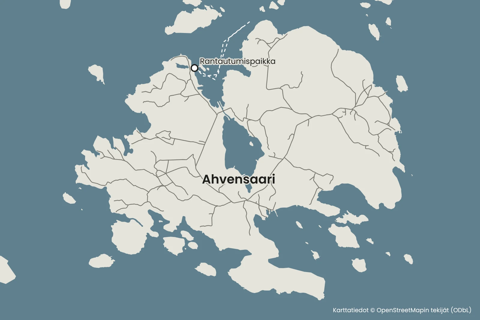
There is no guest jetty on Ahvensaari, and the jetty on the east shore is used by the ferry. The landing place is a natural harbour in Toivola bay on the north side of the island, south of the old bridge embankment (60° 18′ 02.2″ N, 21° 32′ 28.5″ E), and from there it is only a short walk to the quarry lake on the Kilamo headland.
Drop the stern anchor well before the shore and slowly bring the bow to the shore. Tie the bow line to a tree on the shore and tighten the stern anchor line so that the boat does not rub against the rocks.
If mooring with a stern anchor is new to you, ask us for tips before you set off.
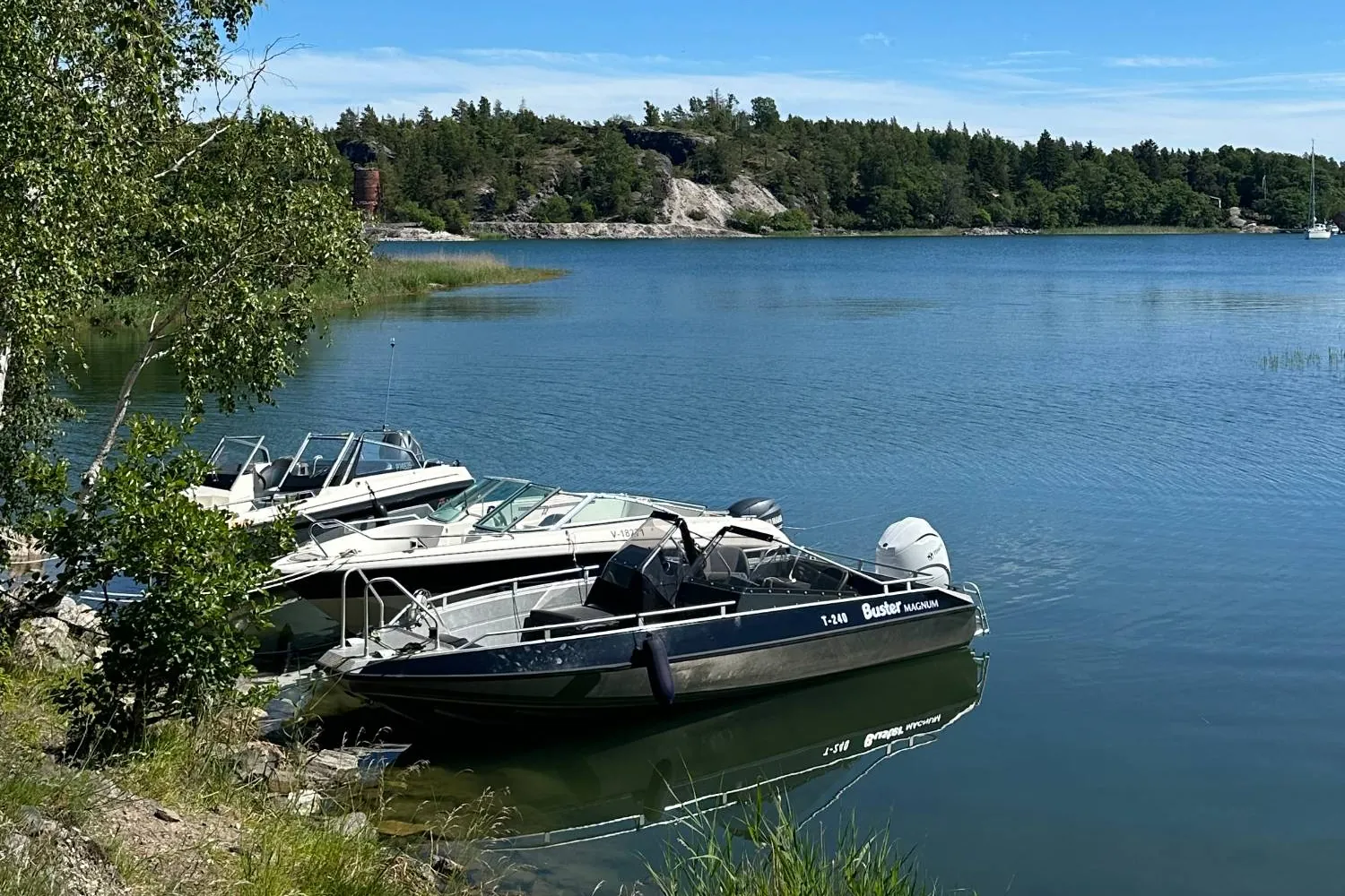
No services – bring everything with you
The island has no shop, café, waste disposal or other services. Bring food and drink for the whole day and take your rubbish home with you.
There are many snakes on the island, and vipers have also been seen among the rocks of the quarry. Wear closed shoes and long trousers, watch where you step and take particular care on the rocks and in stony areas.
Move around the island in line with everyman's rights and respect private yards, as there are many holiday homes on the island. A path runs along the northern edge of the lake with long views out to sea, but walking around the lake is difficult because of the steep cliffs.
You move around the mine lake at your own risk, as there are no safety fences along the edges of the quarry. Walking in the factory ruins is dangerous and prohibited. The old mining area on the Kirmo headland is fenced off and entry is not allowed. Entering the mine caves is also prohibited.
Remember before you set off
- Make sure the stern anchor and lines are ready before landing.
- Food and drink for the whole day.
- A rubbish bag so you can take your rubbish back with you.
- Closed shoes and long trousers for the rocky ground and in case of snakes.
- Clothing suitable for the weather.
Shall we go and explore an old mining island?
Choose a departure point, look at the route and check the Buster Magnum's availability.
Friilo may open in Finnish – you can easily switch the language on the page.
See also
- SeiliPlan a boat trip to Seili from Hovirinta in Kaarina or Särkänsalmi in Naantali. Travel estimates, trip tips and the Buster Magnum for rent.Read the trip guide
- StenskärPlan a boat trip to Stenskär from Hovirinta or Särkänsalmi. Travel estimates, the nature trail, the lookout tower and the island's services.Read the trip guide
- KorpoströmPlan a boat day to Korpoström from Hovirinta or Särkänsalmi. Route, travel time and tips for the Archipelago Centre's exhibitions, the harbour and food.Read the trip guide