
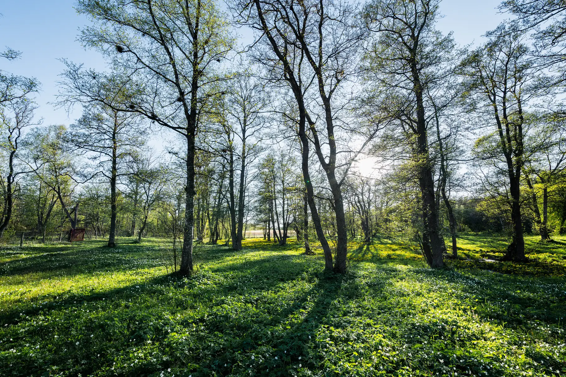
Photo: Jetro Luhtaa.
Jungfruskär by boat – the pearl of the national park in the middle of Kihti
Jungfruskär is a group of islands in the Archipelago National Park, known as the pearl of the Archipelago Sea. A three-kilometre nature trail through a traditional landscape, a picnic and sea views are programme enough for the day. There is no electricity or running water on the island, so bring drinking water and food and set aside a full day for the trip.
Details checked against sources in October 2026.
Services on site
- Guest jetty
- Barbecue area
- Nature trail
- No fuel
Many services are only open in the summer season, so check opening hours on the destination's website.
Why go to Jungfruskär?
Jungfruskär lies in the middle of the open Kihti (Skiftet) waters in the north-western corner of the Archipelago National Park, about 15 nautical miles west of Galtby in Korppoo, and is managed by Metsähallitus. The largest islands in the group are Storlandet, Nölstö and Hamnö. Of Storlandet's 120 hectares, 100 belong to the national park, and Hamnö is private land.
The island's traditional landscape is the oldest traditional landscape area in the national park and one of the most diverse protected areas in Finland, where the cultural landscape meets nature conservation. The island has traditional meadows, wooded meadows, forest, rocks and shore meadows, home to endangered species of traditional habitats such as the elder-flowered orchid and the fragrant orchid. The birches of the wooded meadows have been pollarded, and the branches gathered as winter fodder for cattle.
For centuries the islands have been a safe harbour and stopping place for seafarers, and during the Swedish era there was a sailors' inn on the island. Until the 16th century the island was called Hundskär. From the early 19th century, crofters lived on the islands, growing potatoes and grazing cattle on the meadows and in the groves. The population peaked at 43 in the early 20th century, and a primary school was founded on the island in 1933.
In July 1940, a military fort was established on the island, where nearly 200 men served at its peak. The Finnish Defence Forces handed the island and its buildings over to Metsähallitus in 1999. The 1967 television film Meren kasvojen edessä, based on a novel by Arvid Mörne, was also shot on the island.
Up-to-date information
- Jungfruskär – Visit Parainen (opens in a new tab)
- Jungfruskär – Wikipedia (opens in a new tab)
- Jungfruskär nature trail – Luontoon.fi (opens in a new tab)
- Islands of the Archipelago National Park – Luontoon.fi (opens in a new tab)
- Archipelago National Park – Luontoon.fi (opens in a new tab)
- Nature – Visit Houtskär (opens in a new tab)
- Jungfruskär, Houtskär – Totalvene (opens in a new tab)
Who is this trip for?
The trip suits people interested in nature and traditional archipelago landscapes who want to spend a full day on the water and explore ashore with their own food. The nature trail is fairly easy and takes about an hour, but allow plenty of time for stops.
In June, look out over the meadows: according to Visit Houtskär, Jungfruskär has particularly fine stands of the protected elder-flowered orchid, which blooms in May–June.
You can also rent the Buster Magnum from us for longer, as long as you need. There is a small camping area near the jetty, so you can stay the night on Jungfruskär on a longer archipelago trip.
Route to Jungfruskär
Hovirinta → Jungfruskär
- Distance / one way
- 47 nm
- Travel time / one way
- approx. 2 h
- Fuel / one way
- approx. 35 l
- Fuel / round trip
- approx. 70 l
The fuel estimate is based on a consumption of 0.75 l/nm. Actual consumption depends on the weather, load and driving style.
Jungfruskär is one of our more distant destinations, and the route crosses the open waters of Kihti. Check the weather and wind forecast for the whole day and allow plenty of time for the return trip. There is no fuel on the island, so make sure you have enough fuel before you set off.
Loading the map…
Travel times are estimates without stops and depend on the conditions. The round-trip fuel estimate assumes you return the same way. Also allow time for the destination itself and for the boat handover and safety briefing of approx. 30 minutes at the start of the rental.
Wind forecast: Jungfruskär
Loading the wind forecast…
Suggested plan for the day
This is a flexible idea for a self-guided nature trip to Jungfruskär.
- 01
Check the weather and wind forecast and look at the route and estimated travel time.
- 02
Set off in the morning so that you have time for an unhurried day on the island.
- 03
Moor at the guest jetty in the strait between Hamnö and Storlandet.
- 04
Walk the nature trail clockwise and stop at the bird tower to enjoy the views.
- 05
Have a picnic at the campfire site if no wildfire warning is in force.
- 06
Start the return trip in good time, taking into account the weather and the boat's return time.
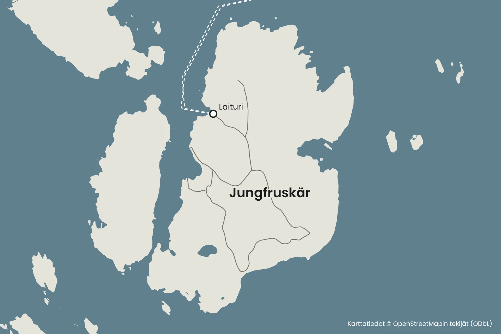
Jetty and arrival
The guest jetty is about 15 metres long and lies in the strait between Hamnö and Storlandet on the west shore of the main island. Next to the jetty there is also a rocky shore suitable for landing. The harbour is open to the north, so check the wind forecast.
Hamnö is private land, so stay on the national park side.
A space at the jetty cannot be guaranteed in advance.
Hiking facilities and national park rules
The nature trail starts near the jetty. According to Luontoon.fi, the circular route is 2.6 kilometres long, about 3 kilometres in total, and takes about an hour. The route is marked with orange markers, and the recommended direction is clockwise. Part of the route follows roads, and along the way there are nature information boards and a bird tower built in 2003.
Near the jetty there is a campfire site, tables and benches, and a small camping area. Always check whether a wildfire warning is in force before lighting a fire. There is no electricity, running water or waste bins on the island.
According to a Metsähallitus notice, the toilet on Jungfruskär is closed until further notice. Check the situation on Luontoon.fi before your trip.
Jungfruskär is part of the Archipelago National Park, where everyman's rights do not apply as such. Camping is only allowed at marked sites. Read the national park's regulations before your trip.
There is no fuel on the island. The nearest place to refuel is Näsby in Houtskär. The Buster Magnum runs on 98E5.
Up-to-date information
- Jungfruskär – Visit Parainen (opens in a new tab)
- Jungfruskär – Wikipedia (opens in a new tab)
- Islands of the Archipelago National Park – Luontoon.fi (opens in a new tab)
- Archipelago National Park – Luontoon.fi (opens in a new tab)
- Nature – Visit Houtskär (opens in a new tab)
- Jungfruskär, Houtskär – Totalvene (opens in a new tab)
Remember before you set off
- Bring drinking water and food for the whole day.
- Check that you have enough fuel and plan refuelling before the return trip.
- Pack shoes suitable for the nature trail and clothing suitable for the weather.
- Bring a rubbish bag and toilet paper, and take your rubbish with you when you leave the island.
Shall we go on a nature trip to Jungfruskär?
Choose a departure point, look at the route and check the Buster Magnum's availability.
Friilo may open in Finnish – you can easily switch the language on the page.
See also
- SeiliPlan a boat trip to Seili from Hovirinta in Kaarina or Särkänsalmi in Naantali. Travel estimates, trip tips and the Buster Magnum for rent.Read the trip guide
- StenskärPlan a boat trip to Stenskär from Hovirinta or Särkänsalmi. Travel estimates, the nature trail, the lookout tower and the island's services.Read the trip guide
- AhvensaariAhvensaari is an old mining island in Korppoo with a clear lake in a former limestone quarry. Boat route, travel time and tips for landing on a natural shore.Read the trip guide