
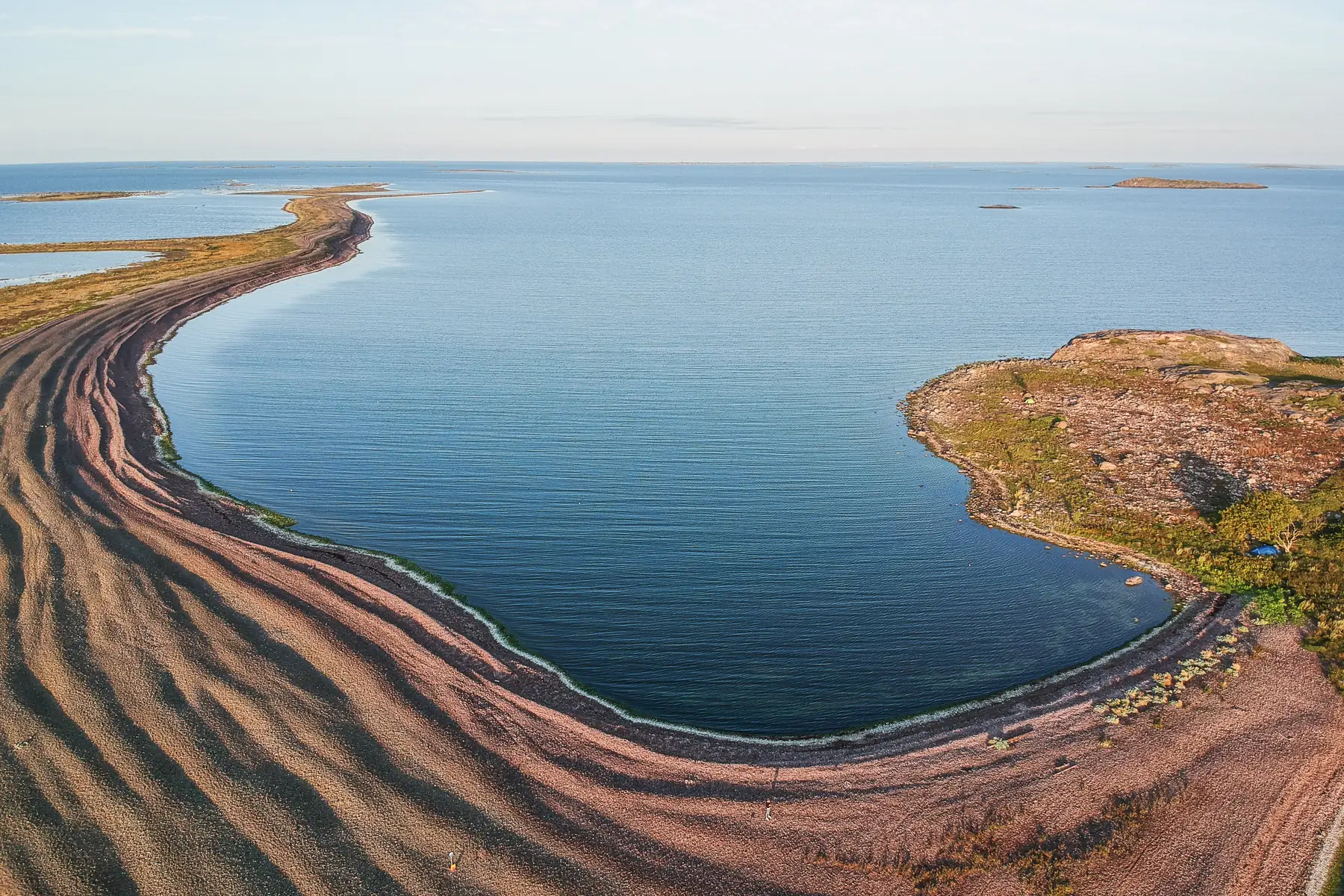
Photo: Jarina Leskinen / VisitPargas.
Jurmo by boat – heather moors at the edge of the open sea
Jurmo is an almost treeless ridge island in the outer archipelago of Korppoo (Korpo), about seven nautical miles north-east of Utö. The island's stony shores, heather moors and wide sea views are unique in all of Finland. In summer the guest harbour has a small shop and a café, and a cultural trail circles the island. Jurmo is one of our longest trips, so only go in good weather and set aside a full day for the trip.
Details checked against sources in October 2026.
Services on site
- Guest jetty
- Drinking water
- Toilet
- Shower
- Sauna
- Café
- Shop
- Barbecue area
- Nature trail
- Septic emptying
- Waste disposal
- No fuel
Many services are only open in the summer season, so check opening hours on the destination's website.
Why go to Jurmo?
Jurmo is an island about five kilometres long and a kilometre wide that formed at the end of the ice age. It is the last above-water section of the Third Salpausselkä ridge, which runs across the whole of Finland, and the ridge continues under water in both directions. Millions of smoothly polished stones lie on the island's shores, and juniper and heather grow on the moors. In August, the island glows with flowering heather.
The gravel and stone island has developed such a rich flora and fauna that it is considered one of the most valuable sites in the Archipelago National Park. During the spring and autumn migrations, Jurmo is one of the best birdwatching spots in the archipelago, and the Turku Ornithological Society's bird observatory has operated on the island since 1962. The tips of the island belong to the national park, and most of the land is owned by the island's original farms.
Jurmo has been inhabited since the Middle Ages, and the island is already mentioned in a 13th-century Danish description of a sailing route. The chapel dates from 1846, and its oldest objects include a reliquary dated to around 1300, a votive ship carved by a sailor who stayed on the island in the 18th century, and a postil – a book of sermons – printed in 1661. There are also tales of pirates: according to legend, the island's forest was burned on the orders of King Gustav Vasa because the islanders lured ships onto the rocks with fires. Jurmo village is part of the nationally significant outer archipelago village settlement.
Who is this trip for?
The trip suits an experienced skipper and a group who want to spend a full day on the water and explore the island on foot. Jurmo particularly appeals to birdwatchers, nature lovers and anyone who wants to experience the vastness of the outer archipelago.
Route to Jurmo
Hovirinta → Jurmo
- Distance / one way
- 49 nm
- Travel time / one way
- approx. 2 h 05 min
- Fuel / one way
- approx. 37 l
- Fuel / round trip
- approx. 74 l
The fuel estimate is based on a consumption of 0.75 l/nm. Actual consumption depends on the weather, load and driving style.
Jurmo is one of our most distant destinations, and the last stretch runs through the open outer archipelago. The island's ridge continues under water, so study the approach carefully on a paper chart. Check the weather and wind forecast for the whole day, allow plenty of time for the return trip and plan refuelling in advance, as there is no fuel on Jurmo.
Loading the map…
Travel times are estimates without stops and depend on the conditions. The round-trip fuel estimate assumes you return the same way. Also allow time for the destination itself and for the boat handover and safety briefing of approx. 30 minutes at the start of the rental.
Wind forecast: Jurmo
Loading the wind forecast…
Suggested plan for the day
This is a flexible idea for a self-guided day trip to Jurmo on a day with good weather.
- 01
Check the weather and wind forecast the evening before and in the morning before you set off, and study the approach on a paper chart.
- 02
Set off early in the morning, as the journey takes about two hours each way.
- 03
Moor at the guest harbour according to the harbour's instructions and visit the exhibition at the Iurima ultima nature hut.
- 04
Walk along the village road to the village and the chapel, and climb Kappelinmäki, the highest point on the island.
- 05
If you have time, continue along the cultural trail to the 'monk's rings' in the eastern part of the island and the Grundvik spit.
- 06
Start the return trip in good time and refuel on the way if needed.
Guest harbour
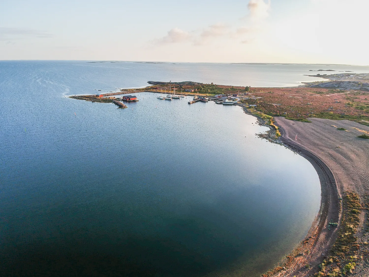
Jurmo guest harbour has about 80 berths. Moor your boat according to the harbour's instructions. In summer, the harbour has a small shop and a café, as well as a sauna, a morning shower, a dry toilet, a barbecue area, drinking water, a waste point, septic emptying and a dishwashing area.
Next to the harbour is Metsähallitus's nature hut Iurima ultima, whose exhibition tells about the island's nature and history.
The harbour is also a ferry stop, so keep the ferry's berth free. Berth availability cannot be guaranteed in advance.
Cultural trail, chapel and access restrictions
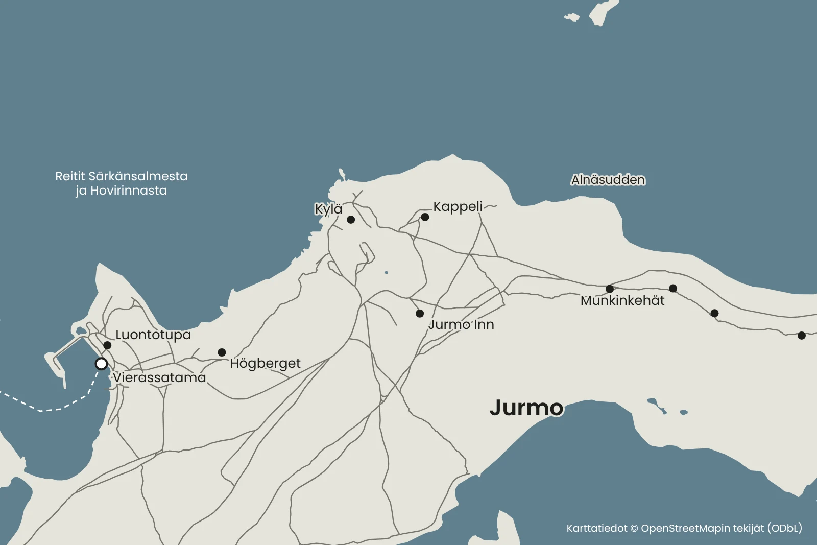
A cultural trail of just over seven kilometres circles the island, presenting both its culture and nature at numbered stops. The trail passes through the village and by the chapel to Kappelinmäki, which at about 18 metres is the highest point on the island. From the Högberg rock, which served as a lookout post during the Continuation War, there are views of the harbour and the village.
In the eastern part of the island there are four stone rings about ten metres in diameter, the so-called 'monk's rings'. They were built in the 15th century at the latest and were probably overnight shelters for fishermen or hunters. From the trail you can make a detour to the Grundvik spit and return to the village via the Alnäsudden natural terrace, shaped by storms and ice into the form of an amphitheatre. The spits are very stony, so walking on them is slow.
The village is about 1–1.5 kilometres' walk from the harbour. Jurmo Inn in the village serves home cooking, but meals usually need to be booked in advance. There are few services, so bring your own food.
Important: to protect nesting birds, there is a ban on access and landing in the western and south-western parts of the island from 1 April to 31 July. Follow the signs in the terrain. In the national park, everyman's rights do not apply as such, and camping is only allowed at designated sites. The national park's camping area and campfire site are at Moringharu near the village harbour.
Vipers have been seen on the island, and there are plenty of ticks in the archipelago in general. Wear closed shoes and long trousers, watch where you step and check for ticks after your trip.
There is no fuel on Jurmo. Refuel along the route, for example at the Seapoint station on Nötö or in Nauvo. The Buster Magnum runs on 98E5.
Accommodation on Jurmo
Jurmo has a national park camping area, rental cottages and Jurmo Inn, which offers full board, so you can stay the night on the island and explore the trails without hurry. Book cottages and accommodation in good time.
Note that there is another island called Jurmo in Åland. When booking accommodation, make sure it is Jurmo in Korppoo.
When you rent the Buster Magnum from us for several days or even a week, you can stay the night and continue your trip the next day. Book accommodation directly with the provider.
Remember before you set off
- Only go in good weather and check the forecast for the whole day.
- Plan refuelling along the route – there is no fuel on Jurmo.
- Check the approach on a paper chart.
- Bring your own food and drinks.
- Pack closed shoes and long trousers for the stony paths.
- Check the nesting season access restrictions before landing.
Shall we head to Jurmo on a fine day?
Choose a departure point, look at the route and check the Buster Magnum's availability.
Friilo may open in Finnish – you can easily switch the language on the page.
See also
- KorpoströmPlan a boat day to Korpoström from Hovirinta or Särkänsalmi. Route, travel time and tips for the Archipelago Centre's exhibitions, the harbour and food.Read the trip guide
- BrännskärBrännskär is an old fishing homestead south of Nauvo with Café Salve, a nature trail, glamping tents and a rental cottage. Boat route and travel time.Read the trip guide
- HoutskärPlan a boat day to Näsby in Houtskär. Route, travel time and tips for the guest harbour, the wooden church, the archipelago museum and a bike ride.Read the trip guide
Similar destinations by theme: Harbours with saunas