
Gunnarsörarna by boat – an outdoor island on the open waters west of Hanko
Gunnarsörarna is a City of Hanko outdoor recreation island about four nautical miles north-west of Tulliniemi. The island has a jetty built in 2022, a lean-to shelter, a campfire site, a dry toilet and a nature trail of about 3–4 kilometres. There are no other services, so bring everything you need.
Details checked against sources in October 2026.
Services on site
- Guest jetty
- Toilet
- Barbecue area
- Nature trail
- No fuel
Many services are only open in the summer season, so check opening hours on the destination's website.
Why go to Gunnarsörarna?
The City of Hanko built a jetty and a nature trail on Gunnarsörarna with a state grant. The nature trail was restored and cleared in summer 2021, and the jetty and gangway were built in spring 2022. Waymarkers and information boards were added along the trail, one of which is about the island's birds.
There were three smallholdings on the islands until the Soviet occupation of Hanko in 1940–1941, and no one has lived on the islands since 1941. Former garden plots, where currant bushes and ash trees grow, are still a reminder of the old archipelago way of life.
Under the Moscow Peace Treaty of March 1940, the Hanko Peninsula was leased to the Soviet Union as a naval base, and the last Soviet soldiers left Hanko on 2 December 1941. During the occupation, a four-gun anti-aircraft battery was built on the island's highest rock, and the trenches in the area are well preserved.
The island's nature is varied: lush groves contrast with pine forest growing on the rocks. Gunnarsörarna suits a day that combines a picnic, hiking and military history in the peace of the outer archipelago.
Up-to-date information
- Gunnarsörarna – City of Hanko (opens in a new tab)
- Gunnarsörarna – Visit Hanko (opens in a new tab)
- The Soviet military base in Hanko 1940–41 – Visit Hanko (opens in a new tab)
- To Hanko by boat – Visit Hanko (opens in a new tab)
- Gunnarsörarna – Onnellinen veneilijä (opens in a new tab)
- Island map data © OpenStreetMap contributors (ODbL) (opens in a new tab)
Who is this trip for?
The trip suits independent hikers, people interested in hiking and military history, and anyone who wants to spend a day in the middle of nature without services. The island is large and in places difficult to get around, so good footwear is a must.
Route to Gunnarsörarna
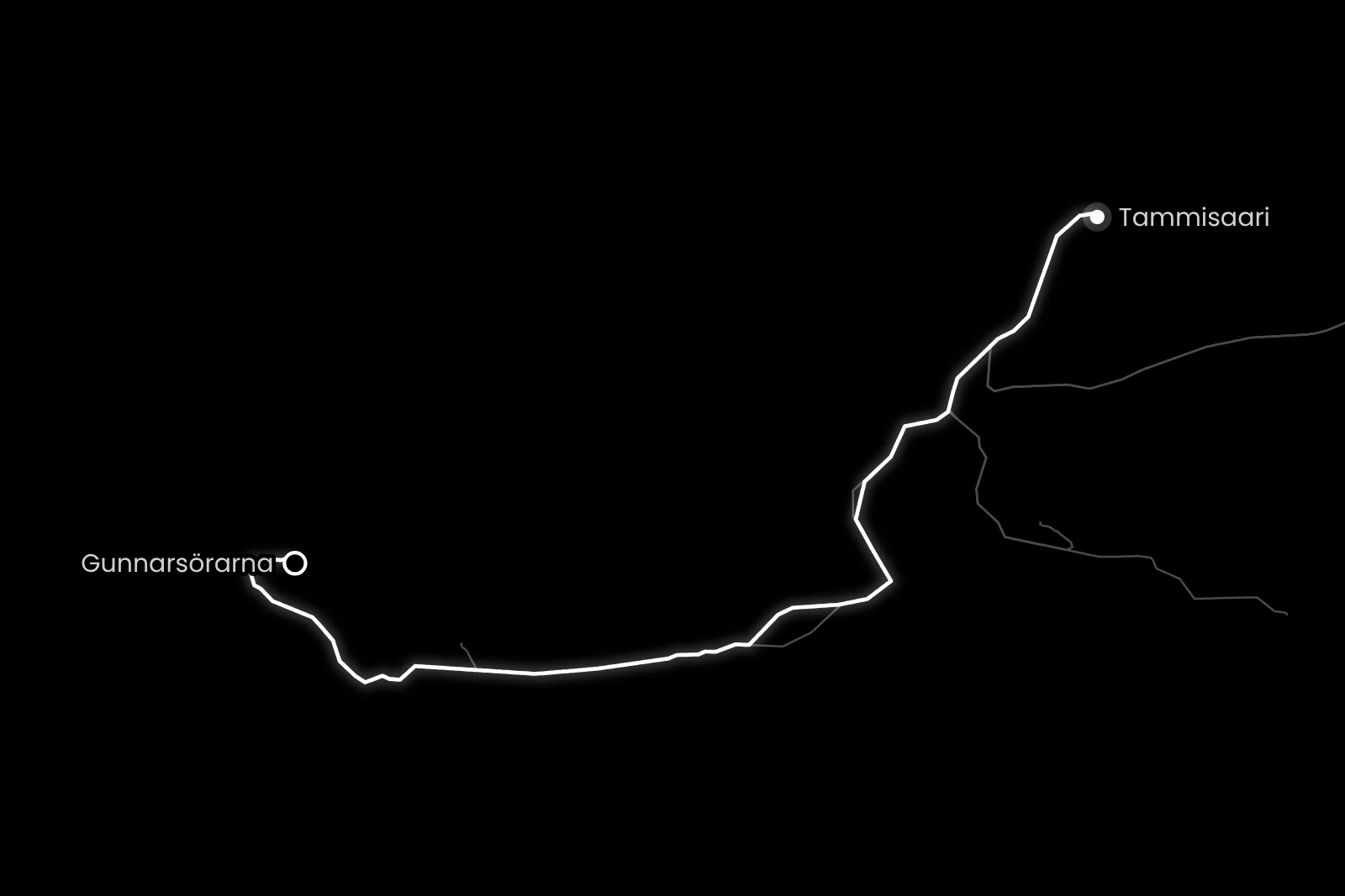
Tammisaari → Gunnarsörarna
- Distance / one way
- 28 nm
- Travel time / one way
- approx. 1 h 20 min
- Fuel / one way
- approx. 25 l
- Fuel / round trip
- approx. 51 l
Travel times are calculated at a cruising speed of 25 knots and include the slower sections of the route. The fuel estimate is based on a consumption of 0.9 l/nm. Actual consumption depends on the boat, the weather, load and driving style.
At the start of the route off Ekenäs and at the end when approaching the Gunnarsörarna jetty, you travel more slowly, and the slower sections are taken into account in the estimated travel time. Gunnarsörarna is the farthest of our destinations from Ekenäs, and the route goes around the south of the Hanko Peninsula to the open waters west of Hanko, so check the weather and wind forecast for the whole day.
Loading the map…
Travel times are estimates without stops and depend on the conditions. The round-trip fuel estimate assumes you return the same way. Also allow time for the destination itself.
Wind forecast: Gunnarsörarna
Loading the wind forecast…
Suggested plan for a day trip
This is a flexible idea for a self-guided day trip to Gunnarsörarna.
- 01
Look at the route and estimated travel time, and check the weather and wind forecast for the whole day.
- 02
Pack a lunch and rubber boots, and bring a map of the island on your phone or printed out.
- 03
Moor the boat at the island's jetty.
- 04
Walk the nature trail and visit the trenches of the anti-aircraft battery on the island's highest rock.
- 05
Have a picnic at the lean-to shelter and grill at the campfire site.
- 06
Start the return trip in good time, taking into account the weather and the boat's return time.
The jetty and the island
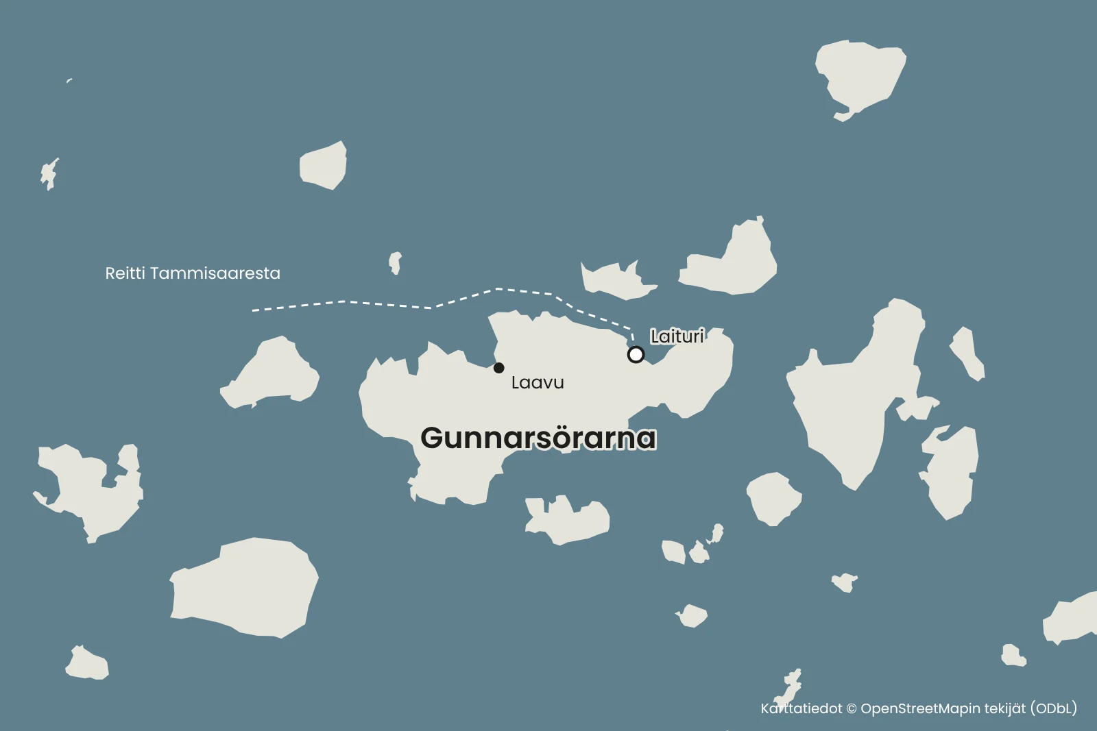
The guest jetty is on the north side of the island, on the western edge of the bay in the middle. You can reach the jetty in your own boat or a chartered boat. The water off the jetty is deep enough even for a small sailing boat, and with a canoe or kayak you can land in front of the lean-to shelter, where it is shallow.
The island is large and in places difficult to get around, so take a map, a phone, rubber boots and a packed lunch with you on the nature trail. You can also print out a map of the island from the City of Hanko's map service.
The nature trail is about 3–4 kilometres long and has information boards along the way. Allow plenty of time for the walk.
No services – bring everything with you
The island has a lean-to shelter, a campfire site and a dry toilet. There are no other services, so bring food and drink for the whole day and take your rubbish away with you.
You can grill at the lean-to shelter. Only light fires at the campfire site, and do not light a fire when a wildfire warning is in force.
In Hanko, the St1 stations are at Itämeren Portti off the Eastern Harbour and in Hangonkylä harbour, but agree on refuelling with the boat owner before you set off.
Up-to-date information
- Gunnarsörarna – Visit Hanko (opens in a new tab)
- The Soviet military base in Hanko 1940–41 – Visit Hanko (opens in a new tab)
- To Hanko by boat – Visit Hanko (opens in a new tab)
- Gunnarsörarna – Onnellinen veneilijä (opens in a new tab)
- Island map data © OpenStreetMap contributors (ODbL) (opens in a new tab)
Remember before you set off
- Food and drink for the whole day.
- Rubber boots or good shoes and a printed map of the island.
- A rubbish bag so that your rubbish comes back with you.
- Agree on refuelling with the boat owner before you set off.
Shall we take a boat trip to Gunnarsörarna?
Rental boats in West Uusimaa are listed on Friilo. Agree on the boat's pickup and refuelling with the boat owner.
See also
- BarösundPlan a boat day to Barösund from Ekenäs or Tervasaari in Helsinki. See the route, travel time and tips for the guest harbour, the restaurant and refuelling.Read the trip guide
- HankoPlan a boat day to Hanko from Ekenäs. See the route, travel time and tips for the Eastern Harbour guest harbour, restaurants and a walk around town.Read the trip guide
- JussaröPlan a boat day to Jussarö from Ekenäs. See the route, travel time and tips for the guest harbour, the sauna and the nature trails on an old mining island.Read the trip guide